Canvas GIS Mapping Edition (Mac) 9.0.4
GIS Mapping support plus illustration, image editing, & presentation features.
CANVAS 9 GIS Mapping Edition includes direct support for Geographic Information System data. You can take measurements in geographic coordinates, import SHAPE & GeoTIFF files into unlimited numbers of automatically aligned overlapping layers.
Software Specs
Publisher:............ ACD Systems
License:............... Shareware
Price:................... $549.99
Expire: ................ 15
File size:.............. 51.9 MB
Downloads:.........
Release date:...... 30 Apr 2004
Last update:........ 07 Jan 2014
Language:............ English
Publisher review for Canvas GIS Mapping Edition (Mac) 9.0.4:
Review by: ACD Systems
The CANVAS 9 GIS Mapping Edition adds native support for Geographic Information System (GIS) data to Canvas. You can take measurements in geographic coordinates, import industry standard SHAPE and GeoTIFF files into unlimited numbers of automatically aligned overlapping layers and choose among the following options:
2,104 Coordinate Reference Systems
67 Operation Methods (like Mercator, Albers Conic Equal Area…)
1,052 Map Projections
302 Geodetic Datums
21 Angular units
45 Length units
The CANVAS 9 GIS Mapping Edition bridges the gap between dedicated GIS analysis software and generic "DTP" software. For many applications CANVAS 9 GIS Mapping Edition can now replace programs costing thousands. For the rest, CANVAS 9 GIS Mapping Edition is now the preferred "last mile" publishing companion to dedicated GIS analysis software.
Requirements:
PowerPC, Mac OS X, 128 MB RAM 100 MB HD, 16-bit graphics, 1024 x 768 res
Operating system:
Mac PPC
Release notes:
Minor Update
Whats new in version 9.0.4:
GIS specific features are now available via a top-level menu. Importing SHP files streamlined & Improved
 9.0.4")
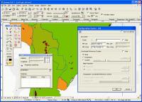
Canvas GIS Mapping Edition (Mac) screenshots:
Canvas GIS Mapping Edition (Mac) download tags:
GeoTIFF Shape files GIS GIS positioning engineering Graphics Vector illustration technical drawing Publication Desktop Publishing Presentation CAD
Copyright information:
Based on 0 ratings. 0 user reviews.